
Four quadrants are presented along with map indicating what has been visited to date. Also see Cycling Through and Beyond YEGVille.
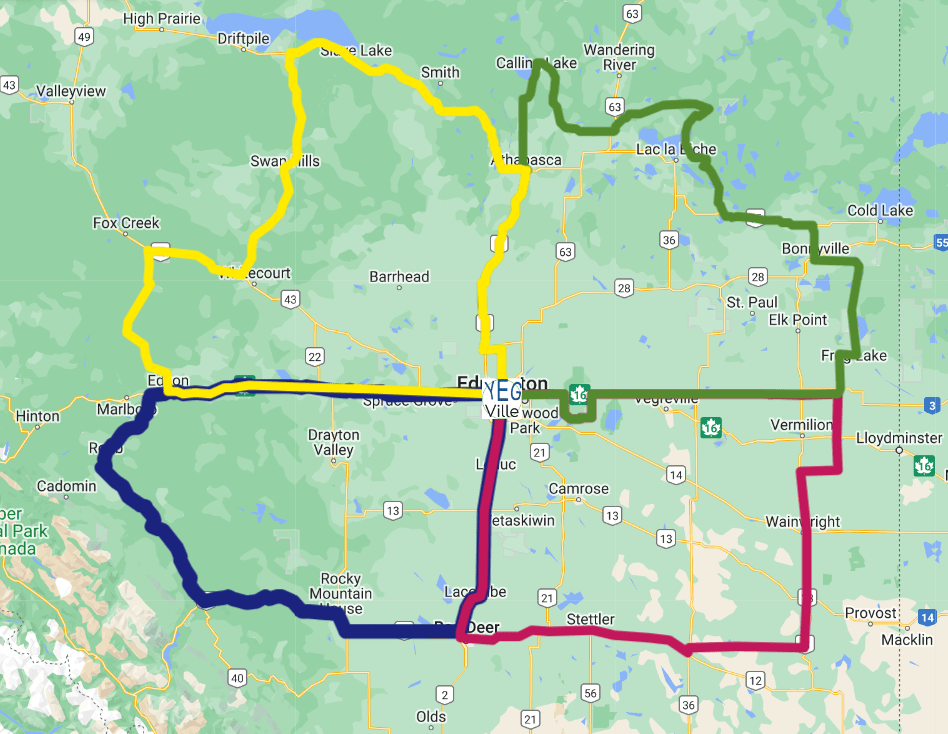
Four Quadrants of Adventure
YEG-Ville is a big place (about the size of the country of Bhutan) , so it is further divided it into four quadrants with the approximate boundaries. Starting in the Northeast and working clockwise:
- Northeast YEGVille: roughly, north of Highway 16 and East of Highway 2 (but including all of Elk Island National Park and surrounding provincial area).
- Southeast YEGVille: roughly, south of Highway 16 and East of Highway 2
- Southwest YEGVille: roughly, south of Highway 16 and West of Highway 2.
- Northwest YEGVille: roughly, north of Highway 16 and West of Highway 2.
If you want to get more precise, poke around this Google map. I have deviated from the above approximations to see cools things and where there are roads!
