An OC and a PNT make up this NA. The OC shows signs of disturbances and abuse in the form of dumping. Otherwise, a good location for fat biking, walking, or snowshoeing.
Bridge Lake is one of those depressions, filled with water, that are generously called a lake. It also has an alias. The lake seems to have two names, either Bridge or sometimes Bouchard [1]. I suspect a shady past and the lake is laying low in Northern Alberta.
OC’s and Leased Land
The equivalent of RR 242 forms the western border for both portions and they are separated by TWP 602. Collectively, the two portions are a full section of land between them. The PNT portion is under a grazing lease [2] but advance notice is not required.
Quarter sections nearby are also Crown land, some of which are leased to local landowners as is the PNT portion of Bridge Lake NA (see a detail from the 2018 Westlock Land Ownership Map in the slide show below).
Numerous ATV Trails and Service Roads
Both the OC to the south and the PNT to the north are crisscrossed with service roads and ATV tracks. In the OC portion, RR 242 is a dual track heading south. This was probably a service road for an oil field installation found in the center of the NA. A more direct access road comes from the north off TWP 602. This north-south corridor extends across the TWP into the PNT portion of the NA which lies to the north.
These former roads or access points are being kept open by moderate Off Highway Vehicles (OHVs) use. A number of these trails are becoming braided.
RR 242 travels north from TWP 602 and ends at a cul-de-sac with a home nearby. Two very friendly, but dirty dogs came out to greet me. The north end of Bridge Lake could be accessed by continuing north along a power line right of way.
Return Visit – Bring Garbage Bags
The area has the potential for a return visit. Either snowshoeing or fat biking are on my radar. Self-propelled activities would be good as the area is at risk for abuse with the ATV traffic and dumping.
Any maps and map views are for general information only. Do not rely on them for navigation or to determine legal boundaries.
The Fast Facts
- Winter Challenge Category: ADVENTURE
- Worth a return visit to snowshoe or fat bike.
- No Washrooms.
- Not Kid Focused
Area Details
- Name/Owner: Provincial Order in Council and Protected Notation Natural Area.
- Is it Worth It and Why Go Here?: 4/5: good potential for snowshoeing, walking and fat biking.
- Wayne Gretzky Units: 70.3km
- Trail Classification: Overall (4 out of 5); Rating: 24; Access: Granted; Develop: Limited Development; Maint: In Disrepair or Abused; Season: All Season: Numerous trails and services roads. Unfortunately, ATV traffic is causing the trails to be braided.
- The Drive Out: The drive out is very pleasant and there are a number of other natural areas nearby if you lose interest in this one too quickly.
- Frank’s Trip Notes
- First done: Bridge Lake NA – 2023-10-01
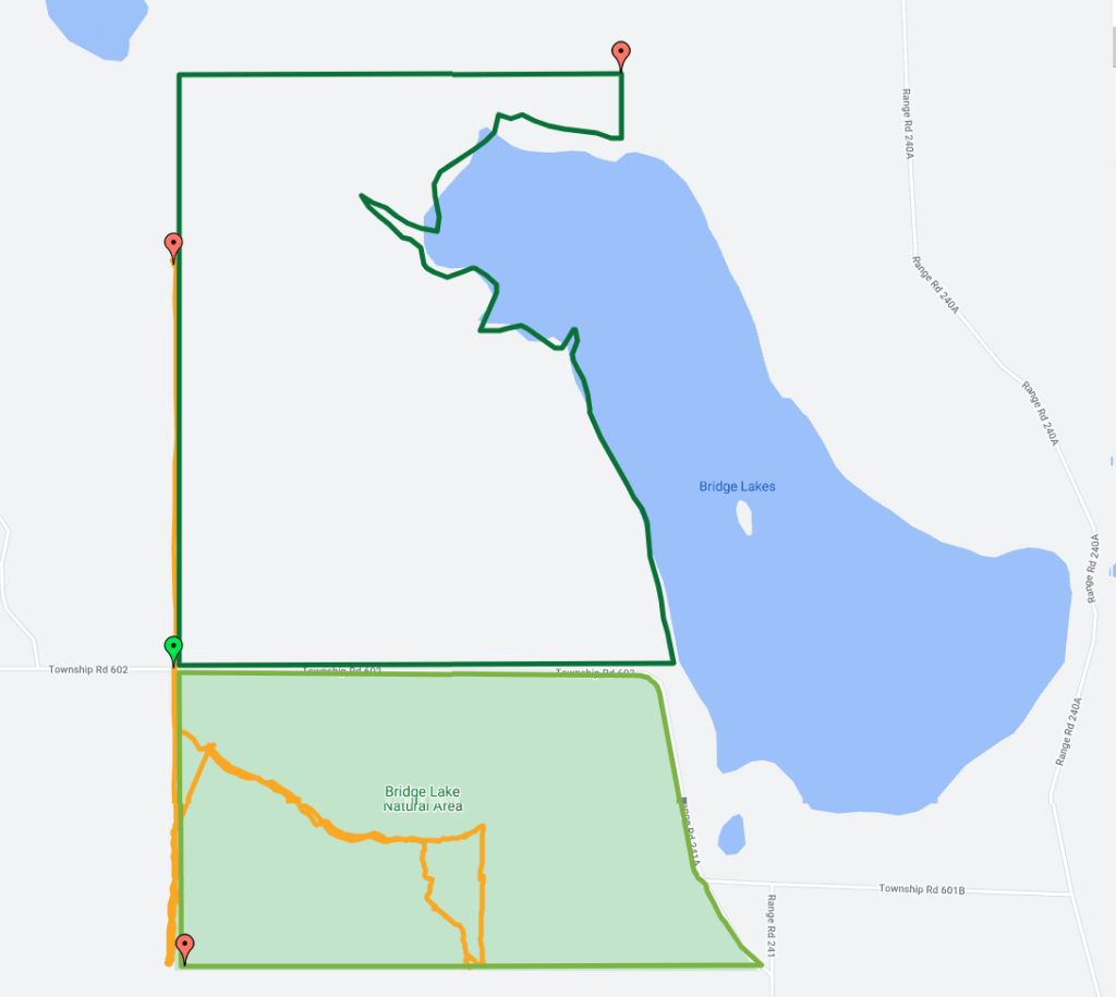
PNT Portion (north, dark green line) and OC (south, light green line) along with the trace of the route taken on 2023-10-01. 
WestlockCountyMap-2018 showing the land leased to local farmers. 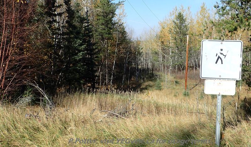
Somewhat shot up no hunting sign along a powerline right of way, Bridge Lake NA, P. Potter, October 1, 2023. Looking northwest at the top of hill (SW Corner) of Bridge Lake NA, P. Potter, October 1, 2023. 
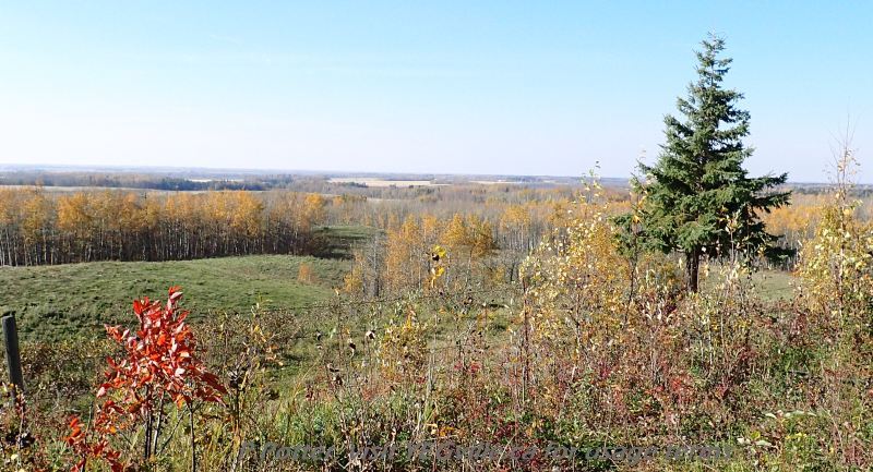
Looking south towards the southwest corner of the Bridge Lake NA, P. Potter, October 1, 2023. 
ATV Track looking west and following the southern border of the Bridge Lake NA, P. Potter, October 1, 2023. 
Moderate to heavy ATV traffic; Y with tracks heading northeast and south east; Bridge Lake NA, P. Potter, October 1, 2023. 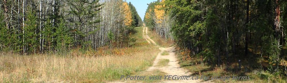
ATV track heading north from the oil field installation, Bridge Lake NA, P. Potter, October 1, 2023. 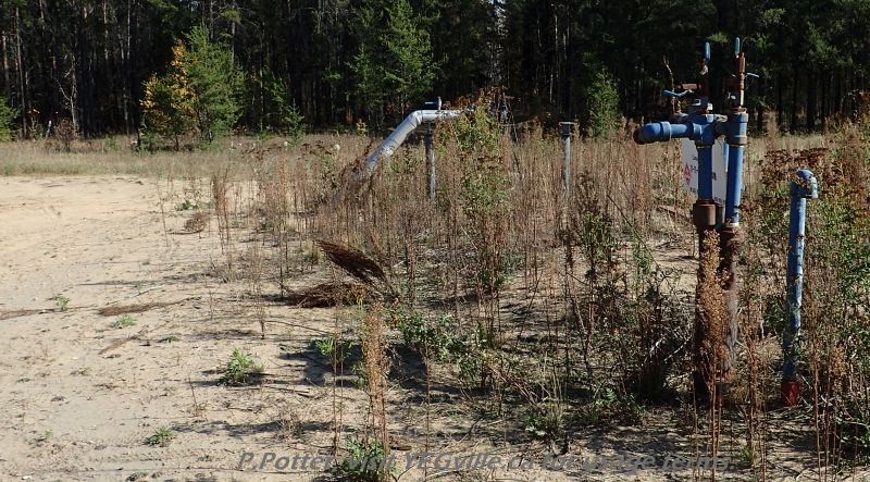
Oil field installation, north east corner of Bridge Lake NA, P. Potter, October 1, 2023. 
Well used track into the north section of Bridge Lake NA, P. Potter, October 1, 2023. 
Urban style street signs marking the NE corner of the NA at RR 242 and Hwy 602. P. Potter, Bridge Lake NA, October 1, 2023.
Notes and Reference
Usage: This site is intended for my personal use only and very select invited guests. My recommendation is for you to stay in bed with the covers pulled firmly over your head.
