Calmar is a small town in central Alberta. Located in the heart of both the agricultural and energy industries of the province. Generally, the loops described below are on secondary paved highways with low to moderate traffic (except where noted). Options and side trips are provided.
Disclaimer
The following rides and information are included here for my personal use only. See Welcome to YEG-Ville for cautions and terms of use. Maps and descriptions are subject to change.
- Disclaimer
- Three Loops (+1) In One!
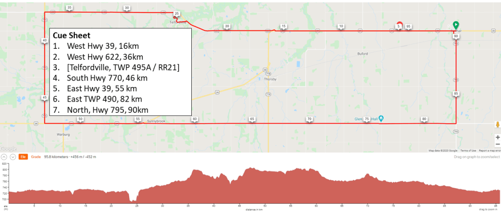
- 90km – Calmar Box Loop;
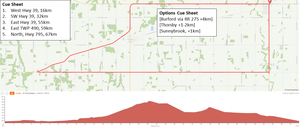
- 67km – Calmar-Sunnybrook Loop
- 50km – Calmar-Churches & Cemeteries Loop
- BONUS 106km Loop!
- Photo Memories
Three Loops (+1) In One!
Three loops nested within each other with distances of 50km, 65km and 90km. A bonus 106km loop added for those want to cycle and visit small town Alberta! The loops can be ridden in either direction but all instructions are given assuming a counter-clockwise travel.
90km – Calmar Box Loop;
- 90km – Calmar Box Loop; first done consecutively on July 31 and August 5, 2020.
- Description: The loop is a longer east-west rectangle. Highway 770 in the west accounts for an addition 350M of elevation gain as compared to the other loops. Enjoy the rolling hills just kissing the foothills of the mountains to the west.
- Statistics: 95.8 kilometers · +/- 456M
- Ride With GPS link and Map: https://ridewithgps.com/routes/33651633.
- CAUTION: Highway 770 in the West has a narrow shoulder and commercial vehicles (e.g. gravel trucks) are on the highway. extreme care should be taken while riding it particularly if uncomfortable or unfamiliar with Highway cycling.
67km – Calmar-Sunnybrook Loop
- 67km – Calmar-Sunnybrook Loop; first done July 31, 2020.
- Description: The loop cuts off the rolling hills to the west. An optional visit to Thorsby is possible returning to Hwy 39 via RR 292. An additional visit to the small town of Warburg can be added but not included in the map.
- Statistics: 67.4 kilometers · +/-114M
- Ride With GPS link and Map: https://ridewithgps.com/routes/33583584.
- CAUTION: The Portion of Hwy 39 going NE from Thorsby to Sunnybrook has a narrow shoulder. Commercial vehicles (e.g. gravel trucks) are on the highway. extreme care should be taken while riding it particularly if uncomfortable or unfamiliar with Highway cycling.
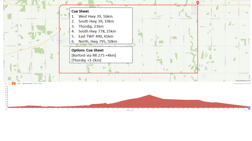
50km – Calmar-Churches & Cemeteries Loop
- 50km – Calmar-Churches & Cemeteries Loop; first done July 31, 2020.
- Description: The loop cuts off both the rolling hills to the west and the SW pie slice from the 65km option. The focus of this route are the churches and photographic opportunities en-route. This includes the town of Thorsby.
- Statistics: 49 kilometers · +/-72M
- Ride With GPS link and Map: https://ridewithgps.com/routes/33612325.
BONUS 106km Loop!
This bonus loop of 106km includes visiting small towns in Alberta! If you are not up for the metric-century, consider driving it. Be sure to get out of your car and walk around though to best enjoy the small-town Alberta vibe. If driving, consider stopping off at some of the locations en-route such as the Warburg Hutterite Colony off Highway 770.
- 106km – Full Calmar with Detours Loop; first done consecutively on July 31 and August 5, 2020.
- Description: The loop is based on the 90km rectangular loop but includes the “Thorsby Pie Slice”.
- Statistics: 107 kilometers +/-447M
- Ride With GPS link and Map: https://ridewithgps.com/routes/33682345.
- CAUTION: The Portion of Hwy 39 going NE from Sunnybrook has a narrow shoulder. Commercial vehicles (e.g. gravel trucks) are on the highway. extreme care should be taken while riding it particularly if uncomfortable or unfamiliar with Highway cycling.
- CAUTION: Highway 770 in the West has a narrow shoulder and commercial vehicles (e.g. gravel trucks) are on the highway. extreme care should be taken while riding it particularly if uncomfortable or unfamiliar with Highway cycling.
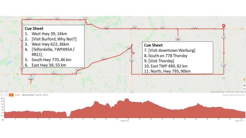
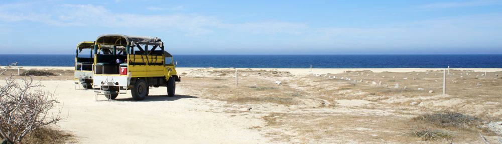
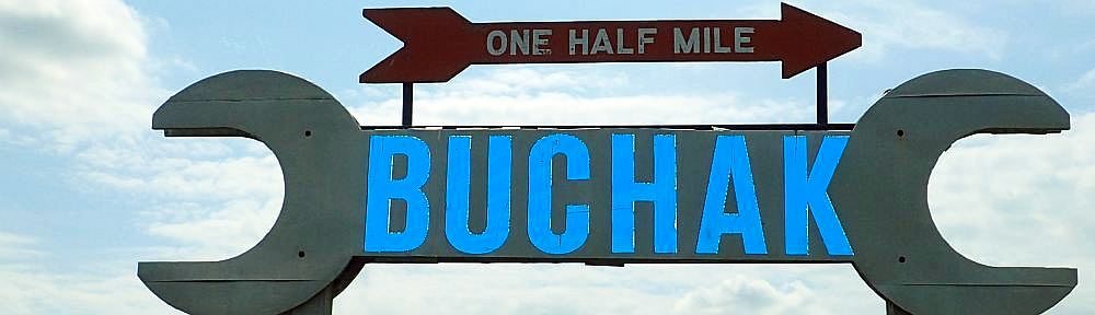
Photo Memories
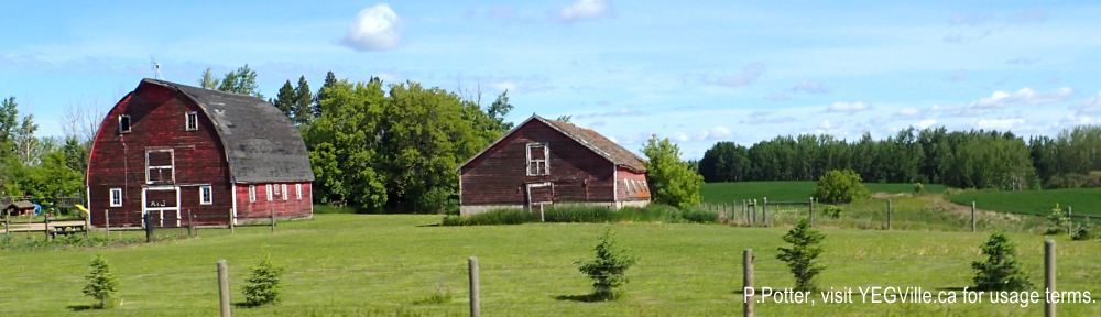
Weather worn barns and buildings, Calmar Bakery Ride, June 18, 2024; P.Potter, visit YEGVille.ca for usage terms. 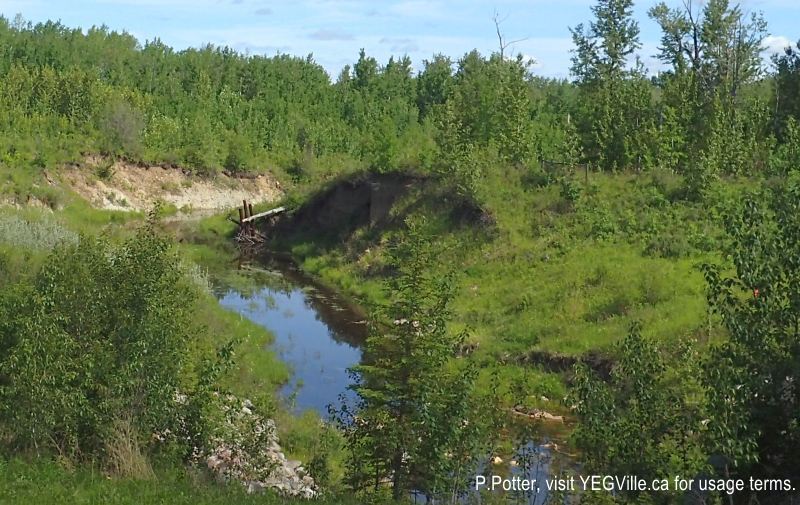
Willow Creek, Calmar Bakery Ride, June 18, 2024; P.Potter, visit YEGVille.ca for usage terms. 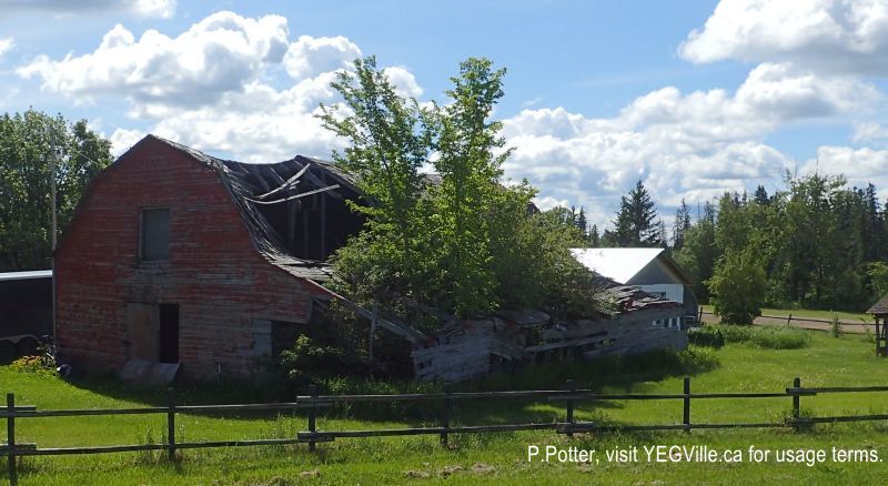
Abandoned Barn near Thorsby, Calmar Bakery Ride, June 18, 2024; P.Potter, visit YEGVille.ca for usage terms. 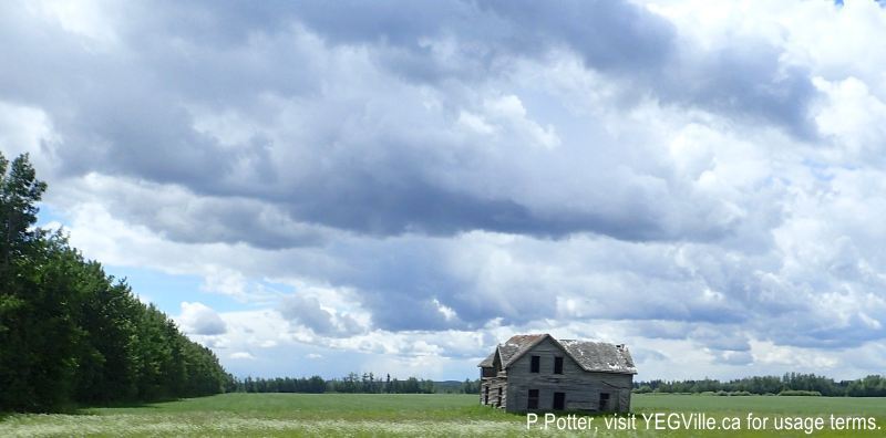
Abandoned Farm House, Calmar Bakery Ride, June 18, 2024; P.Potter, visit YEGVille.ca for usage terms. 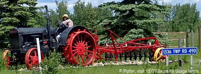
Whimsical landmark, Calmar Bakery Ride, June 18, 2024; P.Potter, visit YEGVille.ca for usage terms. 
Whitsuntide Ukrainian Greek -Orthodox Church of Thorsby, Calmar Bakery Ride, June 18, 2024; P.Potter, visit YEGVille.ca for usage terms.
