<<< Camrose North – WTA Guide Book – Miquelon South >>>
The area has two names: Cooking Lake Moraine and Beaver Hills. We use Beaver Hills, the translation of the Cree word for the area. The name first appears in print on an 1814 map.

Notice that in Beaverhill Lake, Beaverhill is one word. The lake, although not in the Beaver Hills, takes its name from them.
| Trail | Start-KM | End-KM | KM | Notes |
| Miquelon S | 185.2 | 192.4 | 7.2 | Section is Closed |
| Miquelon Lk | 192.4 | 201.6 | 9.2 | |
| Blue Route | ||||
| Southern Rte | ||||
| Miquelon Prk | ||||
| E Miquelon Prk | ||||
| Miquelon N | 201.6 | 212.4 | 10.8 | |
| Ministik | 212.4 | 225.6 | 13.2 | |
| Berg Triple B | 225.6 | 233.8 | 8.2 | |
| Hastings E | 233.8 | 242.3 | 8.5 | |
| St. Margaret’s | 242.3 | 252.1 | 9.8 | |
| Lost Lake | ||||
| Islet Staging |
Natural History Notes
Between 21,000 years ago and 11,000 years ago, the composition of the surface of the Beaver Hills was considerably changed by the movement and weight of an ice sheet sometimes over 1 km thick. Running water sorted some of the mineral material into gravel bars and clay flats.
Two Ice Age features are of particular note to us. The first, the huge melt water channel called Gwynne Outlet, is described on pages 22 and 23. The second, the Cooking Lake Moraine (Beaver Hills), is a collection of debris dumped by the ice sheet. We are left with knob and kettle terrain and soil different from the general area. Of the kettles (depressions), some may be just the dips between piles of debris. Others will have been caused by the melting of huge ice blocks that had become embedded in the debris.
According to Elk Island Park information, at the time of the arrival of the Europeans, the hills were the home of the Sarcee.
“Then came the Cree and forced out the Sarcee in an attempt to continue supplying fur traders with beaver pelts. Beaver, at that time, had been trapped to near extinction in the east. By the late 1800’s, beaver, like the bison, were nearly exterminated here and the Cree left for reserves such as the one at Saddle Lake.”
The area was fairly empty until immigrants interested in farming entered it in the early 1890’s.
Although fires must have periodically ravaged the area, those that got away from the early settlers caused such a disruption to wildlife, loss of spruce timber and damage to the already thin soil that local people and federal and provincial authorities became concerned about conservation. That and other considerations led to the setting aside of Miquelon Provincial Park, the Ministik Bird Sanctuary, the Blackfoot Area and Elk Island National Park. As more of the region’s rough, wooded pastures are being used for subdivisions, these reserved blocks of land have become very important.
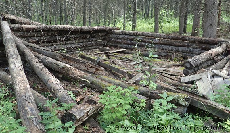
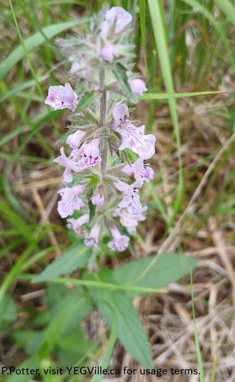
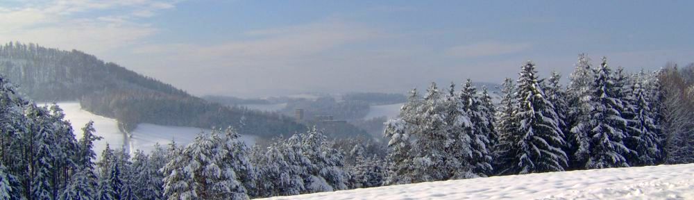
Photos From Beaverhills